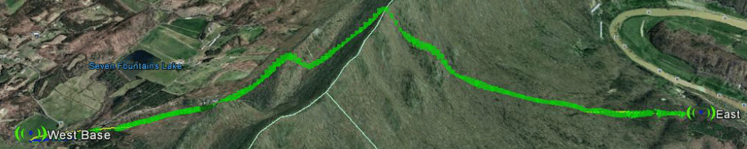
Every year amateur radio operators take to various positions along the entire length of the Appalachian Trail (AT) in an event that experiments with point to point packet radio on VHF. The baseline mode is 1200 bps packet radio… similar to 1200 telephone modems of yesteryear. The goal is to pass the equivalent of a text message the length of the AT using stations spread out along the path to repeat the signal from one end to the other in one long chain. Fifteen stations participate in the annual event in July. Effort ranges from drive up mobile installations to full up hours long hikes to mountain peaks. This is an excellent opportunity to check the link viability with Radio Mobile Deluxe propagation software.
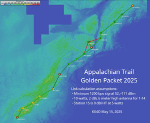
I setup the program with the coordinates of this year’s station positions and configured the stations with the Kenwood TM-D710 radio at ten watts. This is married to a reasonably portable antenna of 2 dBi positioned 6m above ground. This height is mostly to assure clearance over local obstructions not visible in the elevation files feeding Radio Mobile leaving the analysis to check only the long haul link viability over major terrain features. The radio sensitivity is set to 0.6 uV as the minimum single required to decode a 1200 FM radio packet… this value being found via experiment to be a S meter value of 2… or about 0.6 uV.
With these reasonably conservative values we obtain this nice map of the eastern CONUS with links shown.

Since 2009 Radio Mobile has been used to evaluate station location for this radio event with reasonable success. Every year we correlate the above findings with actual observed signal levels and are quite pleased with the overall utility of Radio Mobile to provide a good first look at what links should or should not work.
If your volunteer event requires radio analysis such as above, please contact me john@johnhuggins.com.