Link analysis for AT amateur radio packet event – tackling the Bovina question
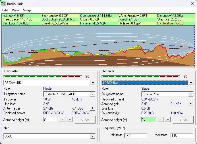
Assessing the utility of including the Bovina station in the packet radio chain to see if it is necessary for a successful radio relay circuit.
Antenna design, RF link analysis and other radio services.
Assessing the utility of including the Bovina station in the packet radio chain to see if it is necessary for a successful radio relay circuit.
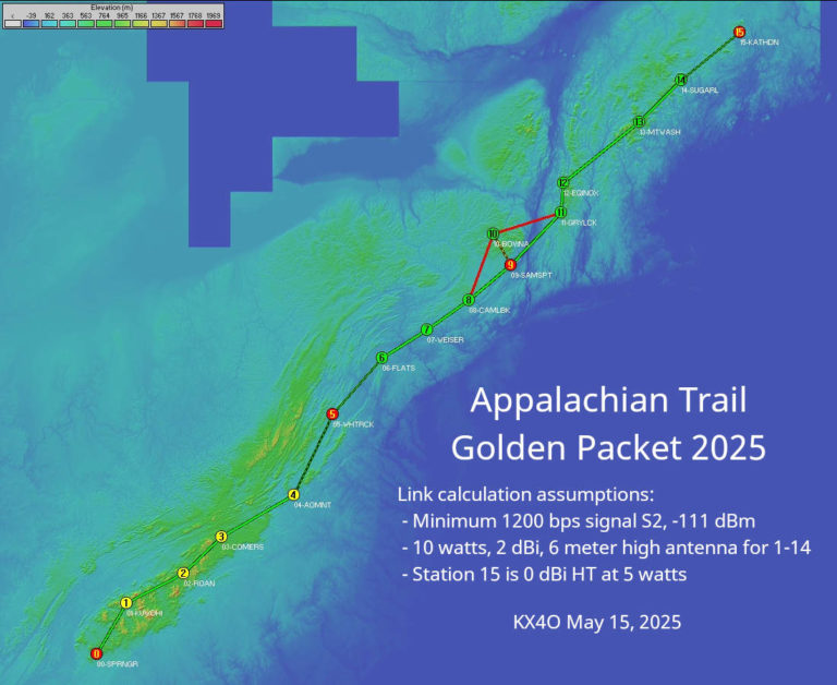
Amateur radio operators put Radio Mobile Deluxe to the test in their annual thousand mile multi-hop VHF packet relay experiment along the Appalachian Trail.
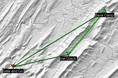
A current project involves analysis of communications along trails during the Northern Virginia Horse Endurance Ride. Of the three annual events, this one, called “No Frills,” requires communication between two checkpoints and a base station. Cell phones are of no use in the valleys. The VHF amateur radio bands are very good at knife edge … Read more