Further analysis of the 2025 Appalachian Trail Golden Packet event was performed with revised assumptions.

Revisions include:
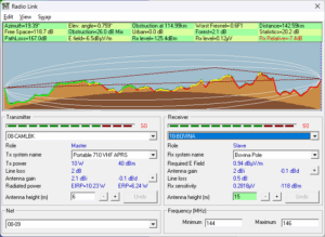
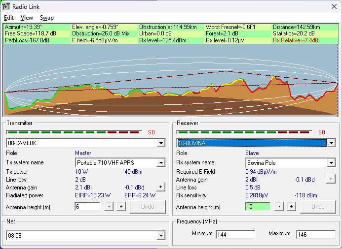
- Station #10 at Bovina is atop a tall structure whereas most stations are at a height of 6m default.
- The link interconnections of Bovina with nearby stations was analyzed a bit more to see how useful this site is.
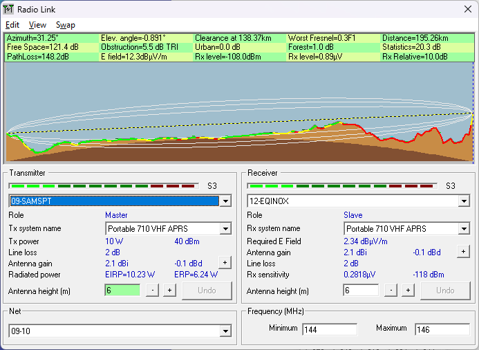
- After consultation with testers, the minimum packet decode signal strength threshold is lowered about 1 S-unit. Signals that meet threshold change from red to yellow. Green is achieved when the signal strength correlates with Bob Bruninga’s original stated minimum signal meter level of 2 to 3.
- The probability was 95% in the previous post, but is added to the graphic’s details.
- The HT atop Mount Katahdin at Station #15 was reduced to 1 watt.
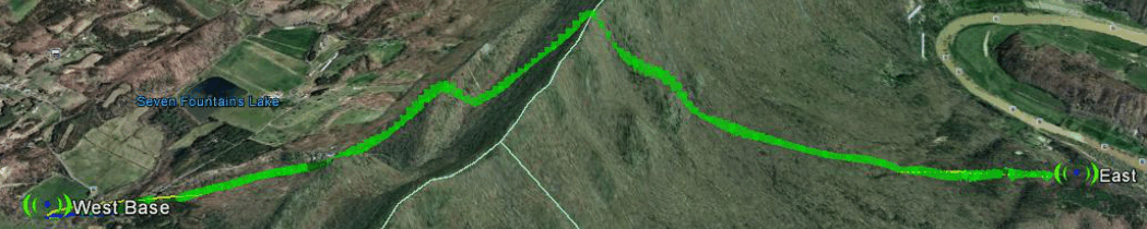
The problem with Bovina
In a word, terrain, as shown in these link profiles…
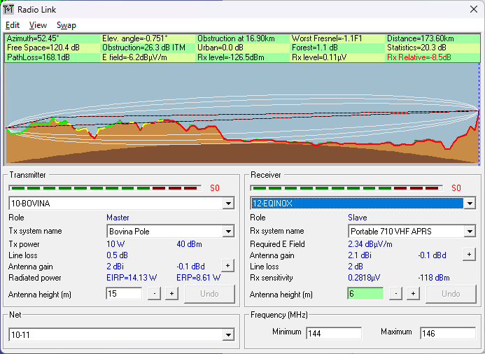
The path around Bovina
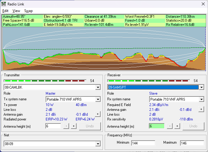
Contrast this with the links from Camelback to Equinox that cross valleys…
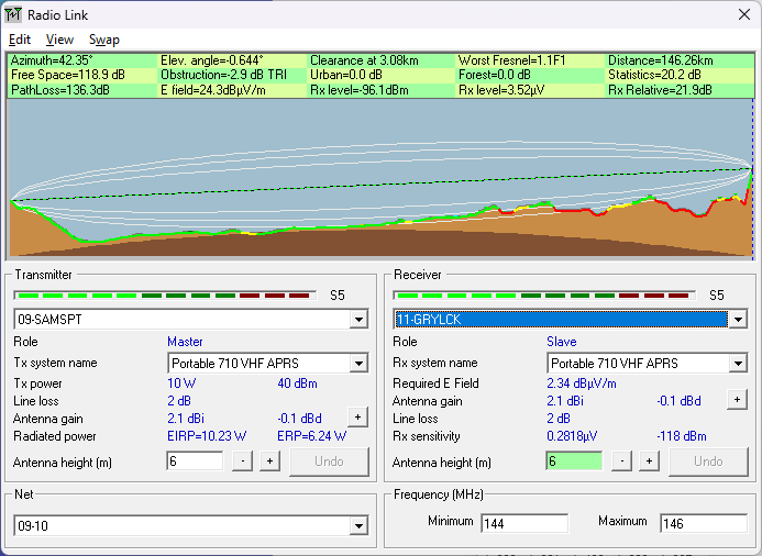
The following image includes the possible radio circuit from Sam’s Point to Equinox…
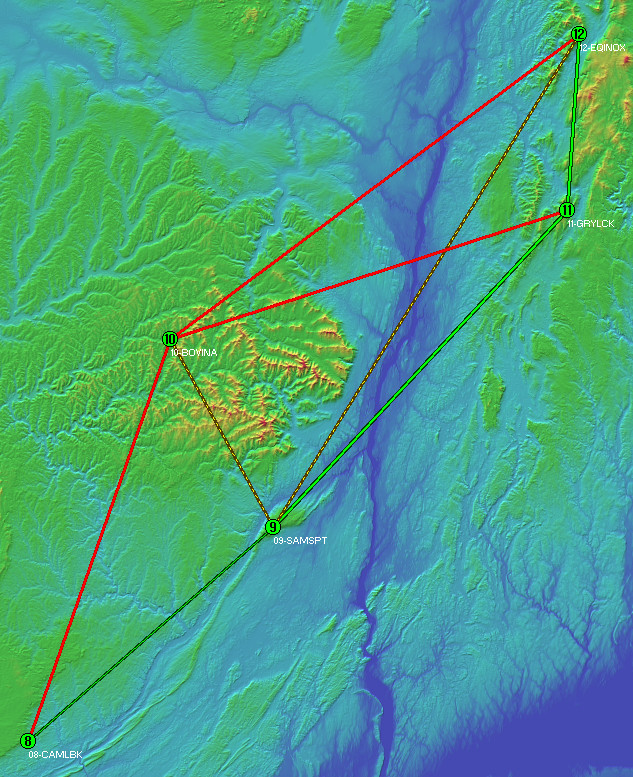
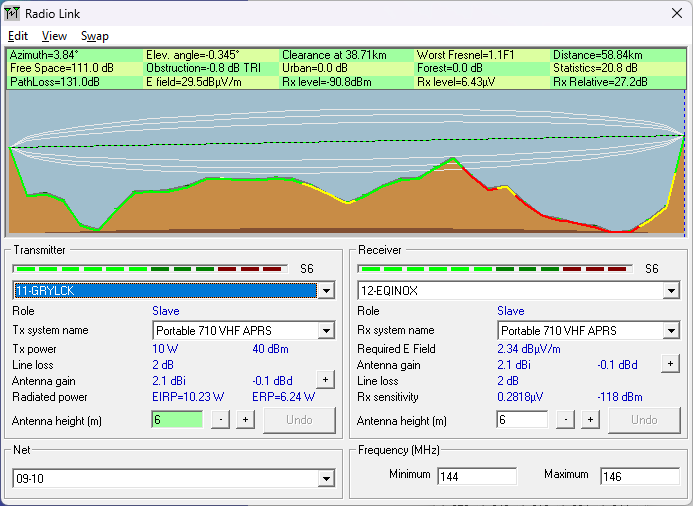
Even the weak circuit from Sam’s Point to Equinox has more utility than any involving Bovina…
Conclusions:
Station #10 (Bovina) has questionable utility given the other radio link choices. Observations of this radio system during previous years has shown it hears well. Indeed the severe requirement to maintain links with 95% probability of success are certainly the reason for the red links. For all practical purposes Bovina will likely work fine, but the ridges between it and every other station do cause concern.
As Bovina adds little the the chain’s link reliability, absent other logistical reasons, its necessity for this packet radio exercise is moot.